The Atlas of Historic Towns: Maps and Plans of Towns and Cities in the British Isles, with Historical Commentaries, from Earliest Times to 1800. the Atlas of Historic Towns: Bristol, Cambridge, Coventry, Norwich
Summary
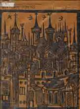
This constitutes the second volume of Historic Towns, a monumental atlas that recreates and records the long-vanished urban Britain that existed before 1800. Each town in the series is closely surveyed and researched by cartographers and scholars, and then presented in a set of detailed large-scale maps accompanied by a long historical essay.
When it appeared in 1969 the first volume was hailed for its union of historical scholarship and revolutionary cartographic techniques. It shed exciting new light on the course of urban development, and provided the very first scientifically accurate maps of British towns during the centuries before industrialization. Banbury, Caernarvon, Glasgow, Gloucester, Hereford, Nottingham, Reading and Salisbury were the very varied subject of the first volume.
This new volume deals at length with four diverse but pre-eminent provincial cities: Bristol, Cambridge, Coventry, and Norwich. As in its predecessor, each is treated individually although the commentaries make it clear that none developed in geographical, political or economic isolation from the rest of Britain or indeed of Western Europe.
Contents:
Bristol / M.D. Lobel and E.M. Carus-Wilson.
Cambridge / M.D. Lobel
Coventry / Joan C. Lancaster
Norwich / James Campbell
Similar Books
-
 Eleanor of Aquitaine
by Alison Weir
-
 Early Lives of Charlemagne
by Einhard
-
 Yale English Monarchs - Henry VIII
by J.J. Scarisbrick
-
 After the Black Death: A Social History of Early Modern Europe
by George Huppert
-
 Edward I
by Michael Prestwich
-
 Henry V
by Christopher Allmand
-
 Tudor Rebellions
by Anthony Fletcher
-
 No Ordinary Man: The Life and Times of Miguel de Cervantes
by Donald P. McCrory
-
 No Ordinary Man: The Life and Times of Miguel De Cervantes
by Donald P. McCrory
-
 Catherine de'Medici
by Robert J. Knecht
-
 Napoleon Bonaparte: England's Prisoner
by Frank Giles
-
 Letters of the Queens of England
by Anne Crawford
-
 Chronicles of the Revolution, 1397-1400: The reign of Richard II
by Christopher Given-Wilson
-
-
-
 Van Vliet's Siam
by Chris Baker
-
 Henry II: New Interpretations
by Christopher Harper-Bill
-
 Edmund Burke: Volume II: 1784-1797
by F.P. Lock
-
 The British inheritance: A treasury of historic documents
by Elizabeth & Andrew Prescott (Eds.) Hallam
-
-
 Crown, Government and People in the Fifteenth Century
by Rowena E. Archer
-
 King Harold II and the Bayeux Tapestry
by Gale R. Owen-Crocker
-
 Anglo-Scottish Relations 1174 - 1328: Some Selected Documents
by E.L.G. Stones
-
 Correspondence of John Wallis
by Philip Beeley
-
-
 Widor: The Life and Times of Charles-Marie Widor, 1844-1937
by Andrew Thomson
-
 The Correspondence of John Wallis
by John Wallis
-
![Cover for The History of Parliament: the House of Commons, 1790-1820 [5 volume set]](/static/covers/eb3fdd7569804d188b3cd82189c9e7a0.png)
-
 Memoirs of Dr. Charles Burney, 1726-1769
by Charles Burney
-
 The dissolution of the monasteries
by Joyce Youings
-
 The History of the Merchant Taylors' Company
by Matthew Davies
-
 An Account of the Pelew Islands
by George Keate
-
-
 Excavations At Knowth: Volume 2
by George Eogan